


Olympic National Park
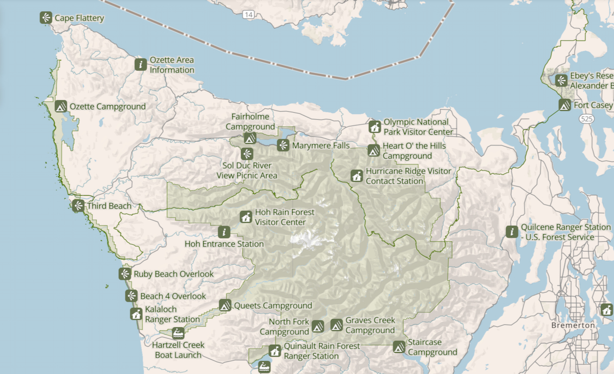
Nestled in the far northwestern corner of Washington State, Olympic National Park stands as one of the country’s most ecologically diverse wildernesses. Officially established in 1938 after decades of conservation efforts, this sprawling sanctuary protects nearly 923,000 acres of untamed Pacific Northwest landscape. From its glacier-capped peaks and ancient temperate rainforests to more than 70 miles of wild, rugged ocean coastline, Olympic packs three distinct ecosystems into a single extraordinary destination.
About Our Hikes
This recap covers five distinct areas of Olympic National Park that we were able to visit: Hurricane Ridge, Lake Crescent, Hoh Rain Forest, the Pacific Ocean (Beach 2), Elwha Valley (Madison Creek Falls), and Marymere Falls. Exploring this park felt like stepping into several different worlds all in one trip. From wandering beneath moss-draped giants in the rainforest to listening to the waves crash along the coast and chasing waterfalls near Lake Crescent, every stop offered its own unique magic. Bill and I packed so many unforgettable moments into our time here, and I’m excited to take you along on our Pacific Northwest adventure!
Animal Encounters
Olympic National Park was packed with wildlife sightings, both from the trail and the car. We were lucky enough to spot a bear safely from the road, while all our other animal encounters happened up close while we were hiking.

Hurricane Ridge: Mountain Views and Alpine Trails
Hike Overview
- • Location: Hurricane Ridge in Olympic National Park
• Start/Finish: parking lot near trailhead
• Course Type: out and backs
• Course Surface: paved and dirt
• Distance: 2.15 miles
• Moving time: 54:14
• Average Pace: 25:17 minute/mile - • Elevation Gain: 452 feet
• Elevation Range: 5,058 feet to 5,459 feet
• Weather: 61°, cloudy, and windy
• Date of Hike: July 27, 2026
• Start time: 3:24 PM - • Route map from Strava:

Pictures Tell the Story
Our first stop in Olympic National Park was Hurricane Ridge. What started as a simple plan to walk to the initial viewpoint quickly turned into a full-on summit push!


When the paved path ended and the steep, root-covered dirt trail began, I definitely regretted not swapping my sneakers for my hiking boots. My trusty Hokas held up fine, though they are now covered in a permanent layer of Hurricane Ridge dust as a souvenir of the incredible view.


We paused along Hurricane Ridge to soak in the incredible alpine views before heading to the top.


The trek back down offered another perspective of the beautiful alpine scenery we had enjoyed on the way up.

Garmin Stats
Garmin map and elevation chart…


Lake Crescent: A Magical Roadside Stop
We kicked off our second day in Olympic National Park with a quick roadside pull-off along Lake Crescent. During our 20-minute stop, we were treated to an incredible sight: watching a double rainbow glow through the mist until the morning fog lifted to reveal a full, vivid rainbow where we could actually see both ends touching down!


Hoh Rain Forest: Wandering Through the Hall of Mosses
Hike Overview
- • Location: Hoh Rain Forest in Olympic National Park
• Start/Finish: parking lot near trailhead
• Course Type: loop
• Course Surface: dirt (mud)
• Distance: 1.03 miles
• Moving time: 32:30
• Average Pace: 31:36 minute/mile - • Elevation Gain: 88 feet
• Elevation Range: 599 feet to 696 feet
• Weather: 53° (feels like 47°) and raining
• Date of Hike: July 28, 2026
• Start time: 11:40 AM - • Course maps from Strava:

Pictures Tell the Story
Next up was the legendary Hoh Rain Forest. Getting in required a bit of patience—we waited in line at the ranger booth for an hour and a half because of limited parking inside. The rangers were carefully managing crowd control by operating on a strict “one car in as one car leaves” system, but the anticipation only made driving into the forest that much more exciting!

We started on the flat, paved Mini Trail before connecting to the Hall of Mosses Trail, where we spent the majority of our time exploring the Hoh Rain Forest.

Once we turned onto the Hall of Mosses Trail, it felt like entering a completely different world beneath an endless canopy of draped spikelichen and towering Sitka spruces. We walked along a mostly flat natural path of packed dirt and soft forest floor, which included a lot of mud and a tangled web of exposed tree roots.

I took a quick trail selfie beneath the massive Sitka spruces. Surrounded by towering trees and lush foliage, it was impossible not to feel amazed by this place!

Thick curtains of spikelichen and moss hang heavily from every limb of these ancient bigleaf maples, creating a spooky canopy above the forest floor. Standing beneath their draped branches felt like stepping right into an enchanted woodland!

Lush sword ferns lined the muddy dirt path, creating a vibrant green corridor through the rainforest. Watching our footing on the damp, root-laced ground was all part of the fun as we meandered deeper into the canopy!


A fallen nurse log resting right alongside the path, serving as a rich, decaying bed for new mosses and saplings to sprout. Seeing life regenerate directly from these fallen giant trunks is one of the most remarkable parts of the forest ecosystem.

Garmin Stats
Garmin map and elevation chart…


Beach 2: A Peaceful Walk along the Pacific Ocean
To wrap up the day, we hopped onto Route 101 and headed toward the coast to visit Beach 2—one of several distinct beaches located within Olympic National Park. We followed its dirt path as it wound down through the coastal trees, emerging right onto the shores of the Pacific Ocean for a peaceful late afternoon walk along the water.


We soaked up the chilly sunshine and crisp sea breeze right on the shore at Beach 2. It was the perfect, serene ending to a full day of exploring Olympic National Park!

Madison Creek Falls: Exploring the Elwha River Valley
Hike Overview
- • Location: Madison Creek Falls Trail in Olympic National Park
• Start/Finish: parking lot near trailhead
• Course Type: out and back
• Course Surface: paved
• Distance: 1.58 mile
• Moving time: 31:43
• Average Pace: 20.07 minute/mile - • Elevation Gain: 234 feet
• Elevation Range: 257 feet to 386 feet
• Weather: 62° and mostly cloudy
• Date of Hike: July 29, 2026
• Start time: 10:36 AM - • Course maps from Strava:

Pictures Tell the Story
The following day centered on Olympic National Park’s stunning waterfalls. After entering the Elwha Valley, we parked to admire the sweeping views of the beautiful Elwha River before heading out on our first walk of the morning.


Once we made our way to the trailhead, we enjoyed a short, relaxing walk to Madison Creek Falls along the paved path.


After taking a few pictures of the beautiful falls, I turned to continue my walk, leaving my husband behind with his tripod set up to capture his own perfect shot.

Upon turning onto Olympic Hot Springs Road—which is closed to vehicular traffic due to extreme flooding and severe wash-outs—I immediately saw this sobering sign. Fortunately, the road was wide open and filled with plenty of other walkers and cyclists, making me feel confident that any nearby cougars would stay far away!


After giving my husband plenty of time to take his photos, I turned back to meet him. He was still in the middle of shooting a time-lapse, but wrapped it up shortly after I got back.

The wait was definitely worth it—here is his picture of Madison Creek Falls!

Garmin Stats
Garmin map and elevation chart…


Marymere Falls: Our Final Stop in Olympic National Park
Hike Overview
- • Location: Marymere Falls Trail in Olympic National Park
• Start/Finish: parking lot a third-mile from trailhead
• Course Type: out and back
• Course Surface: dirt and roots
• Distance: 2.21 mile
• Moving time: 54:14
• Average Pace: 24:34 minute/mile - • Elevation Gain: 432 feet
• Elevation Range: 584 feet to 889 feet
• Weather: 63° and partly cloudy
• Date of Hike: July 29, 2026
• Start time: 12:17 PM - • Course maps from Strava:

Pictures Tell the Story
Our final stop in Olympic National Park was Marymere Falls, another gorgeous waterfall tucked away in the Lake Crescent area.

The trail to Marymere Falls starts on a wide, level gravel path through towering old-growth trees. Dappled sunlight filtering through the dense canopy made for a peaceful and inviting start to our hike!

When we came upon this huge tree, my husband spread his arms wide to show the sheer scale of this ancient forest giant! Standing next to these massive, mossy roots really puts the majesty of the old-growth trees into perspective.

Crossing the log footbridge over Falls Creek offered a fantastic view upstream into the lush, mossy ravine. Once across, the trail transformed into a set of rustic wooden and dirt steps leading up the hillside toward the waterfall.


Reaching the highest point of our hike, we were treated to a stunning view of Marymere Falls—though we had to wait our turn for a spot at the busy overlook to capture a photo!

After taking in the view, we descended a set of wooden and dirt steps to get a lower, less crowded perspective of the falls (this photo looks back up at the stairs we just came down).
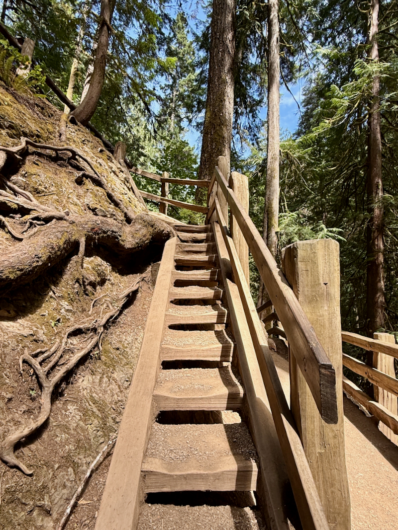
We were thrilled to find that the view from below was even better and far less crowded—in fact, my husband and I were the only ones taking pictures from that spot!

On our way back down to the trailhead, we took our time soaking in the lush green forest one last time. The wooden handrails guide visitors along a lovely winding dirt path framed by giant trunks, mossy branches, and vibrant sword ferns!

Not to be outdone by Bill, I had to get my own picture standing at the base of this massive forest giant! Standing next to these towering old-growth trees makes you feel delightfully small.

Passing back through the stone-faced tunnel under Highway 101 signaled that our hike was coming to an end. It’s such a cool piece of park infrastructure, allowing hikers to cross safely beneath the busy road right near the trailhead!

Before finishing our hike, we paused to take in this breathtaking view of Lake Crescent! The vibrant blue, crystal-clear water framed by lush, forested mountains made for a picture-perfect finish to our time on the trail.

Garmin Stats
Garmin map and elevation chart…


Final Thoughts on Our Hikes
Looking back on our time in Olympic National Park, we were blown away by just how incredibly diverse and stunning this region is. Whether we were walking under a canopy of ancient mossy giants, listening to the crash of the ocean waves, or following a forest stream up to a cascading waterfall, every trail offered something truly special. If Olympic National Park isn’t on your travel bucket list yet, we’d highly recommend adding it! It was an unforgettable adventure, and we can’t wait to return to explore even more of its beauty.
Questions
- • Have you ever visited Olympic National Park, or is it on your travel wishlist? ~ This was our first visit.
- • Which picture or location from myr recap was your favorite? Let me know in the comments below! ~ It’s hard to pick, but I think the Hoh Rainforest was my favorite.
- • Do you think you’d be more of a rainforest hiker or a beach wanderer? ~ rainforest hiker
I’m linking up with Jenn from Runs with Pugs and Jenny of Runners Fly for Tuesday topics Link-Up. Be sure to check out not only the hosts’ posts, but those of the other great bloggers joining in on the fun!

We went to all of these places and hikes when we visited this area. Such beautiful places! I thought the nurse trees were quite interesting.
I am torn on seeing a cougar. It would be pretty amazing- bit also crazy scary!