


Hickman Bridge
Hickman Bridge was carved by water flowing from the Fremont River and it’s tributaries through the area over millions of years, eroding and leaving behind a natural bridge. Carved into Navajo Sandstone, this majestic 133-foot bridge towers approximately 125 feet above the arroyo below. The large opening underneath allows visitors to wander beneath while taking in the beauty of the stately rocks on one side and the wash on the other.
Hickman Bridge Trail
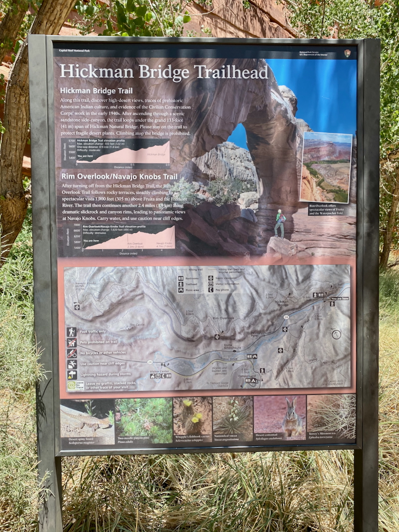
Located within Capitol Reef National Park along Highway 24, the Hickman Bridge Trail is a must-do hike! Hiking along the trail, visitors enjoy both high-desert and canyon views, local plant and animal sightings, and evidence of prehistoric American Indian civilization.
This moderate effort hike is roughly two miles roundtrip, has a decent amount of climbing and several areas of walking through deep sand, but it’s well worth the effort in order to enjoy visiting the stunning natural bridge. The hike is mostly in full sun, so visitors should be aware to dress appropriately and carry plenty of water.
Signs remind hikers to stay on the trail to protect the fragile desert plants. and that climbing on top of the bridge is prohibited.
Hike Overview
- • Location: Hickman Bridge in Capitol Reef National Park
• Start/Finish: trailhead parking lot
• Course Type: out-and-back with a loop at the halfway point
• Course Surface: dirt, rocks, slickrock, and sand
• Distance: 2.23 miles
• Moving Time: 1:01:30
• Average Pace: 27:34 minute/mile
• Elevation Gain: 1,105 feet
• Elevation Range: 5,068 to 5,738 feet
• Weather: 84° and sunny, climbing to 86°
• Date of Hike: June 26, 2025
• Start time: 2:00 PM
Making Our Way to Hickman Bridge
With only 16-17 parking spaces, we luckily got one of the last spots at the trailhead of this popular trail. There’s also a porta potty located within the parking area.
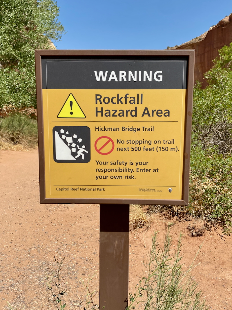
Point taken and the next few pictures were taken while hiking along behind my husband, not while stopped.
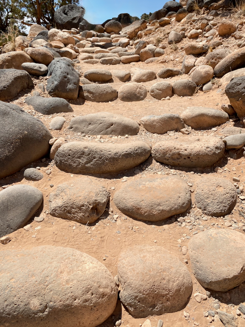
Climbing started immediately as we made our way out of the arroyo on sandy carved rock stairs and slickrock along a few switchbacks.


Volcanic black boulders standout and decorate the desert field next to the trail. These hardened lava rocks were transported to Capitol Reef with flowing debris from melting glaciers within the last 150,000 years and provide a stark contrast to the lighter-colored indigenous rocks.

During the late 1930’s and early 1940’s, the Civilian Conservation Corps (CCC) built trails in national parks including Capitol Reef and most likely built these steps using this combination of sedimentary and volcanic rocks.


We missed a trail sign which took us to this magnificent view of the lush valley below – home to the community of Fruita. If you ever find yourself in Fruita, Utah, be sure to buy a fresh homemade pie at the Gifford Homestead. My husband and I each enjoyed one for lunch just before our hike (apple for me and peach for him).

Backing up, here’s the missed trail sign – we went straight instead of turning right. I suspect the beautiful view ahead distracted us.

As we made our way around the slickrock, we were shaded by the fascinating striated rock wall. After admiring the rock wall, we turned for our first view of Hickman Bridge.

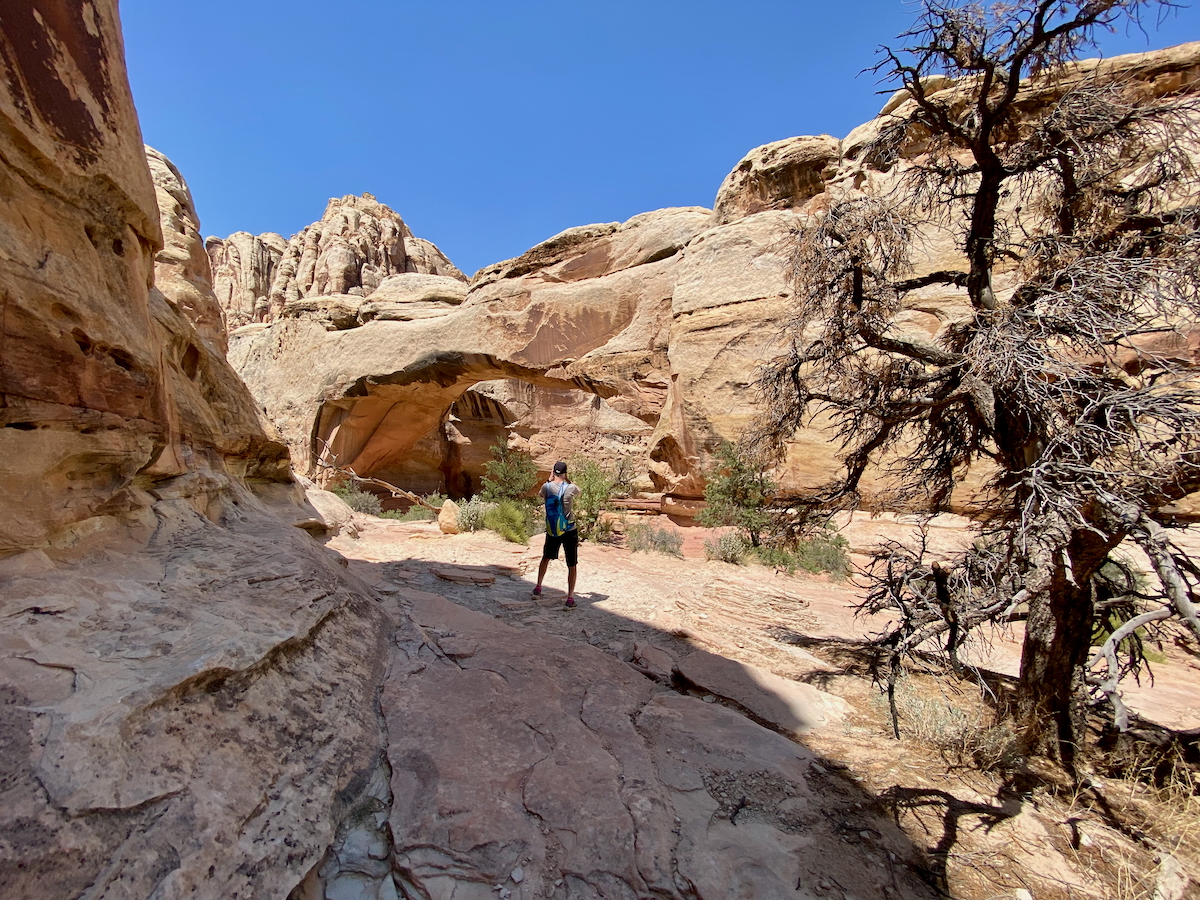
Another hiker offered to take our picture in front of the bridge, and who were we to turn down a touristy pose opportunity?

After our paparazzi encounter, we walked under the bridge to view it from the opposite side, taking it in from different angles.

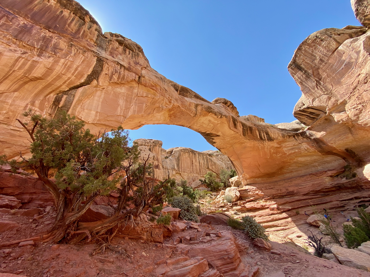
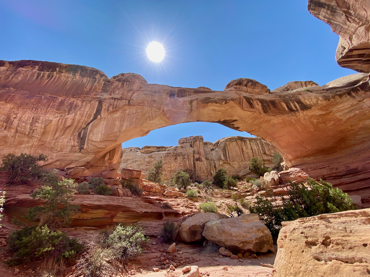

After satisfying our bridge picture-taking-quota, we made our way back along the loop trail, hiking in the reverse direction of what is shown on the sign.

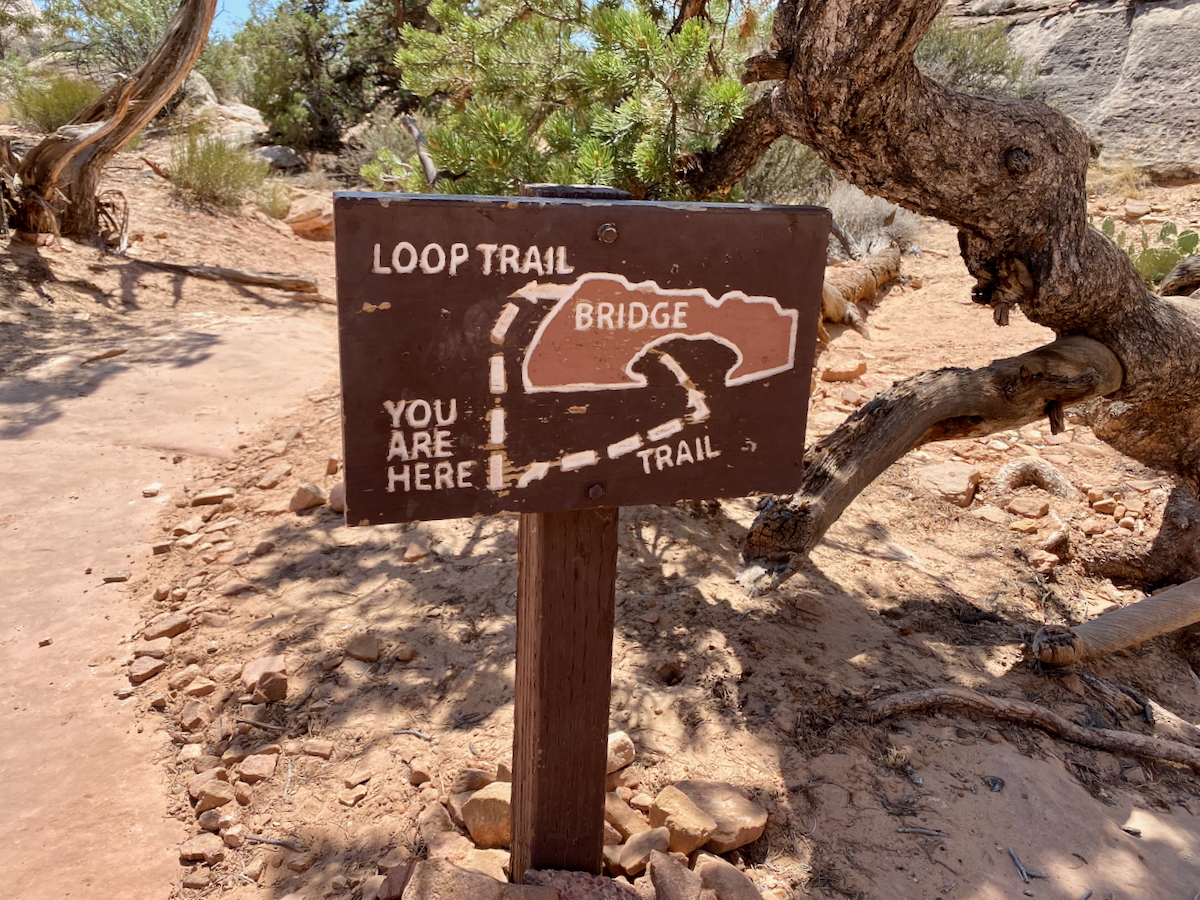
As we made our way back to the trailhead, we walked along a lower section of trail which took us through deep sand that we’d avoided on our hike to the bridge. Unintentionally, we had earlier walked on a slickrock formation that hugged the wall and kept us above the actual trail.


Back on the original trail we had hiked in on, we reversed our earlier course as we made our way back to our car, anticipating a huge sip of ice cold water waiting for us in our cooler.


We made our way along the trail now paralleling the Fremont River, mindful not to stop during the final 500 feet, aware of the rockfall hazard. With the parking lot in sight, we were happy to be almost done as we picked up our pace, completing another beautiful hike on a gorgeous southern Utah summer day!

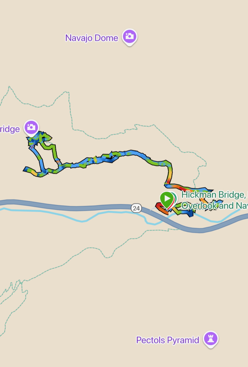
Garmin Stats
Garmin map and elevation graph…

Final Thoughts on Hiking to Hickman Bridge
Huge fans of the southern Utah desert, we enjoyed exploring the trail leading to the beautiful Hickman Bridge, and of course were in awe of the bridge itself. The varying rock formations, high-desert, and canyon views made for interest throughout the hike from beginning to end.
Questions
- • Do you know the difference between a natural bridge and an arch? ~ I learned on our trip that natural bridges are created by flowing water erosion and arches are formed by wind erosion.
- • Have you visited Capitol Reef National Park? ~ This was our first visit.
- • Where do you prefer to hike, barren deserts or lush forests? ~ both
What a gorgeous hike, Debbie! Hickman Bridge looks absolutely majestic. And that missed trail sign detour sounds like it was meant to happen!
I didn’t know the difference between a natural bridge and an arch either, so I learned something new here. I think I’d enjoy hiking in lush forests a bit more, although deserts do have their own kind of magic.
It was a gorgeous hike, Catrina! Hickman Bridge was my favorite trail while in southern Utah. And yes, missing the trail sign must have been meant to be. 🙂
I didn’t know that about arches and natural bridges – super interesting!
This is a gorgeous hike and I’m so glad you got to take it! I also love that you were able to get a little bit “lost” by that gorgeous view!
Another beautiful experience!
Thanks, Jenn, I’m loving reliving our summer road trip as I recap our excursions. 🙂
And yes, the difference between arches and natural bridges is very fascinating, isn’t it?
We have been to Capitol Reef NP. Fruita was our favorite! We camped there. Impressive that those ladies get up so early to bake all of the pies!
How fun to camp in Fruita! I think I first read about the pies on your blog. 🙂