


Natural Bridges National Monument
Over millions of years, three stately sandstone natural bridges were carved by rushing water in an area that now makes up Natural Bridges National Monument. Declared a national monument in 1908 by Teddy Roosevelt, Natural Bridges National Monument is home to three bridges – Sipapu, Kachina, and Owachomo – all named in honor of the Ancestral Puebloans who were once native to the area. Horsecollar House, an ancient cliff dwelling can also be found in the park.
Overlooks and trailheads to these three natural bridges as well as a cliff dwelling are conveniently connected to the visitors center by Bridge View Drive, a nine-mile one-way paved loop road. There is ample parking at each overlook/trailhead allowing visitors to take their time whether sneaking a quick peep or hiking for a closer look.
First National Park Unit
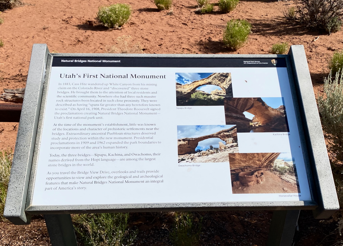
From the sign pictured below, “In 1883, Cass Hite wandered up White Canyon from his mining claim on the Colorado River and ‘discovered’ three stone bridges. He brought them to the attention of local residents and the scientific community. Nowhere else had three such massive rock structures been located in such close proximity. They were described as having ‘spans far greater than any heretofore known to exist.’ On April 16, 1908, President Theodore Roosevelt signed the proclamation creating Natural Bridges National Monument-Utah’s first national park unit.”
Sipapu Bridge
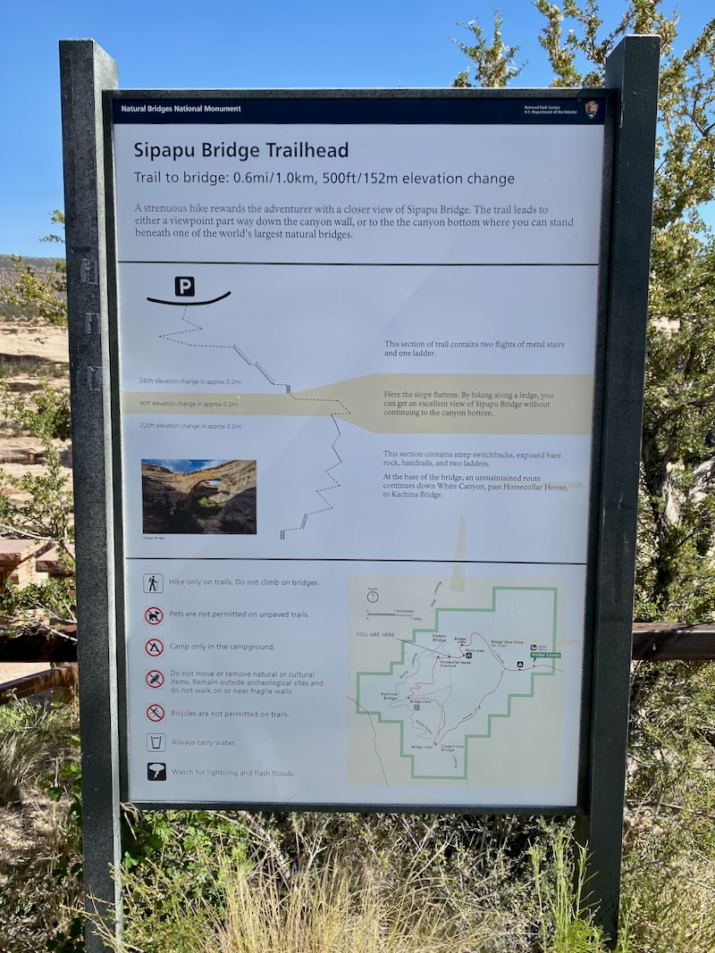
The first stop while driving counter-clockwise from the visitors center on Bridge View Drive is the Sipapu Bridge viewpoint and trailhead. With plenty of time on our hands, our goal was to hike down for a closer look at the bridge.

- • Location: Sipapu Bridge in Natural Bridges National Monument
• Start/Finish: trailhead parking lot
• Course Type: out-and-back
• Course Surface: sand, slick rock, man-made stairs, and ladders
• Distance: .43 mile (turned early, chickened out at the ladder)
• Total Time: 15:05
• Average Pace: 35:20 minute/mile
• Elevation Gain: 146 feet
• Elevation Range: 5,986 to 6,202 feet
• Weather: 74° and sunny
• Date of Hike: June 25, 2025
• Start time: 10:36 AM
From the overlook, and even before starting our hike down the trail, we got our first and only view of Sipapu Bridge.

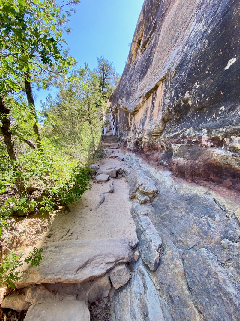
The trail started out easy enough on loose sand as we made our way to the descent into the canyon.

Sets of stair guided us down – so far, so good.

Next up was a relatively short ladder which unbelievably freaked me out. I attempted to get on it, but chickened out before getting my second foot off the rock (mind you, a much younger Deb stood on a 20-foot ladder to hang wallpaper trim at the top of the wall next to a vaulted ceiling).
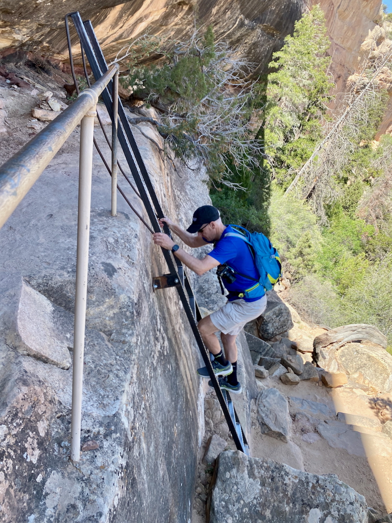
Unwilling and afraid to move on, I asked my husband if he minded if we ended our hike before getting an up close look at Sipapu Bridge. He understood so we turned and made our way back up to the parking lot, reversing our hike down.


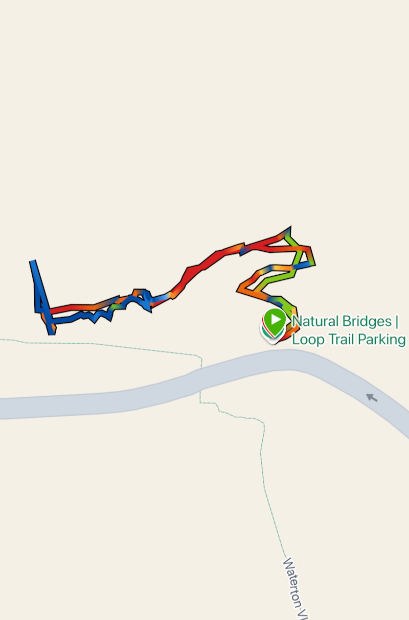
Garmin map and elevation chart…

Horsecollar Ruin Overlook
The second point of interest along Bridge View Drive is Horsecollar House Overlook. In addition to the three natural bridges, cliff dweller ruins can be found in Natural Bridges National Monument at Horsecollar House Overlook.
- • Location: Horsecollar House Overlook in Natural Bridges National Monument
• Start/Finish: trailhead parking lot
• Course Type: out-and-back
• Course Surface: sandy gravel and slick rock
• Distance: .75 mile
• Total Time: 18:11
• Average Pace: 24:16 minute/mile
• Elevation Gain: 171 feet
• Elevation Range: 6,036 to 6,197 feet
• Weather: 76° and sunny
• Date of Hike: June 25, 2025
• Start time: 11:00 AM

The easiest of the four hikes within Natural Bridges National Monument, the trail to the Horsecollar House Overlook is relatively flat.

As the trail makes it way toward the viewing point, railing guides visitors and protects them from the steeper edges.

Rocks line and mark the trail as it makes its final approach to the dwelling overlook…


It is not known exactly how the Ancestral Pueblo used the dwellings; however, it is known that they lived in the Four Corners area from AD 1 to AD 1300.

Cliff dwelling view from the overlook…

Zoomed in views of the cliff dwellings…


Garmin map and elevation chart…


Kachina Bridge
The third stop along Bridge View Drive is Kachina Bridge viewpoint and trailhead. Hopeful that there wouldn’t be any steep vertical descents using ladders, I started our hike feeling positive that I’d be able to complete it.

- • Location: Kachina Bridge in Natural Bridges National Monument
• Start/Finish: trailhead parking lot
• Course Type: out-and-back
• Course Surface: sand, gravel, and slick rock
• Distance: .75 mile (turned early, chickened out at the steep drop-off)
• Total Time: 17:23
• Average Pace: 23:18 minute/mile
• Elevation Gain: 214 feet
• Elevation Range: 5,865 to 6,058 feet
• Weather: 76° and sunny
• Date of Hike: June 25, 2025
• Start time: 11:34 AM
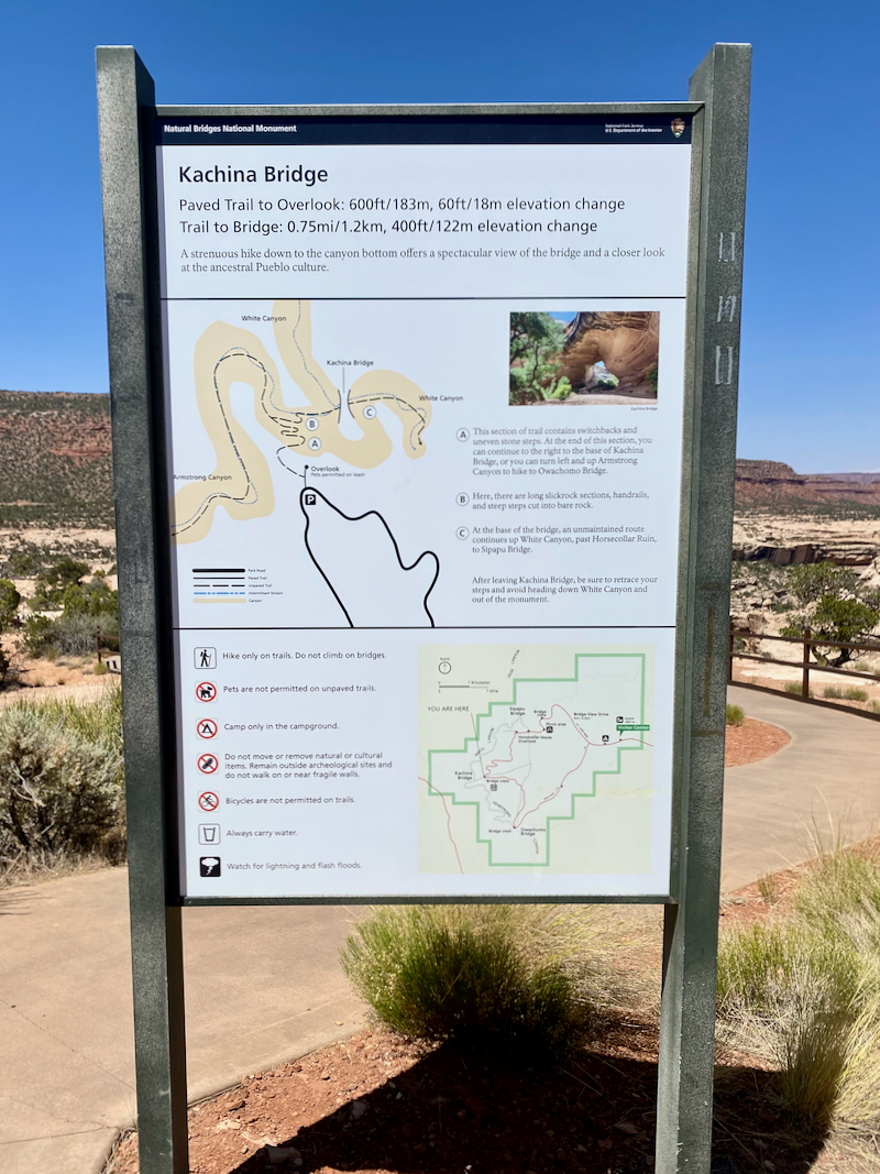
Kachina Bridge can be seen just a short distance from the parking lot at the viewpoint…

Close up of Kachina Bridge…

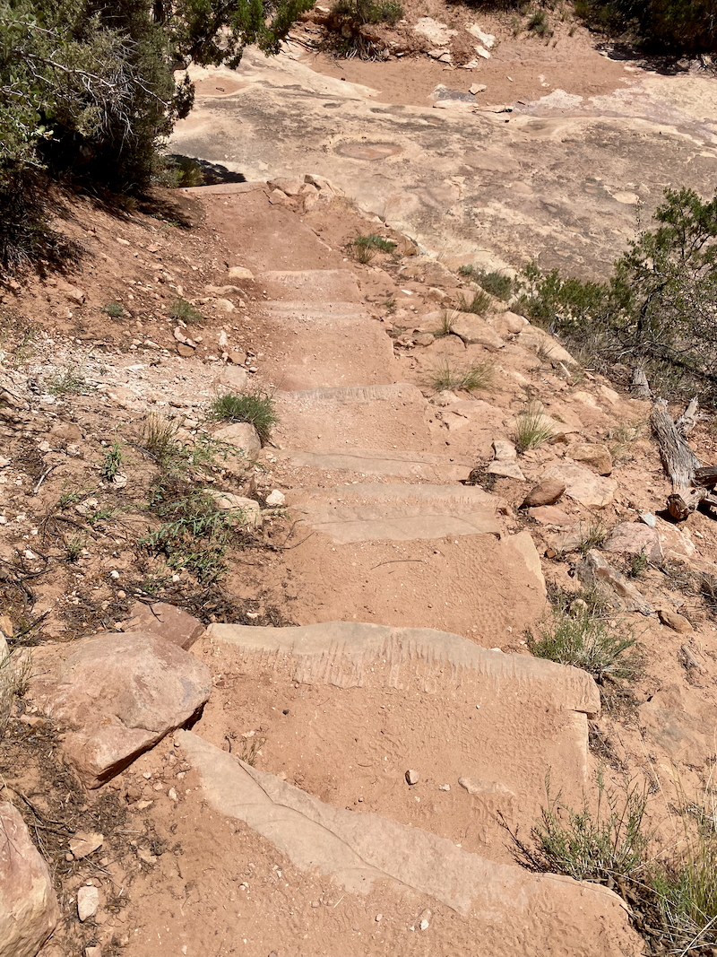
The trail starts rather innocuously with steps carved into the slick rock. Hand rails are positioned in steeper areas.


Unfortunately, there was no railing when the trail got really hairy. After hiking down angled slick rock toward carved steps, if we were to continue, we would need to make a u-turn and follow a sandy path with an extremely steep drop-off on its lower side. With no room for error and not one to normally give up, it was at this point that I chickened out once again.


Happy to be on flatter ground as we made our way back to the parking lot…


Garmin map and elevation chart…


Owachomo Bridge
The forth and final stop along Bridge View Drive in Natural Bridges National Monument is Owachomo Bridge viewpoint and trailhead. At 1 for 3 on the day, I really hoped I’d be able to make it to the bridge without having to turn early due to my fear of heights.

- • Location: Owachomo Bridge in Natural Bridges National Monument
• Start/Finish: trailhead parking lot
• Course Type: out-and-back
• Course Surface: sand and slick rock
• Distance: .78 mile
• Total Time: 22:18
• Average Pace: 28:38 minute/mile
• Elevation Gain: 201 feet
• Elevation Range: 5,922 to 6,124 feet
• Weather: 78° and sunny
• Date of Hike: June 25, 2025
• Start time: 12:18 PM

The trail started out easy enough, but hadn’t the trails to the two previous bridges?

The trail continued to be mostly slick rock and sand…

With the bridge in view, we still needed to descend a bit, but this time on easy to maneuver steps cut into the rock…

As the bridge drew closer, we descended steps built into the hill until we came to large flat rocks under the bridge.

With the shadow of Owachomo Bridge in front of me, I looked up, borrowed a phrase from my little granddaughter and said, “I did it!”


Before turning to make our way back to the parking lot, we hiked beyond Owachomo Bridge for a view from the back side.

Garmin map and elevation chart…


Final Thoughts on Visiting Natural Bridges National Monument
We had a great time hiking around the three bridges and the cliff dwellings in Natural Bridges National Monument. Were I not afraid of heights, our hikes would have been longer and we would have had better views of two of the three bridges. Still, though, we were able to enjoy viewing the many geological and archeological features of the area while soaking in the sunshine on a delightful day.
Questions
- • Have you heard of Natural Bridges National Monument? ~ I had not until we started planning our trip. Interestingly, though, we have a Natural Bridge State Park in Virginia that my husband and I have never visited despite it being right off the interstate between our house and the farm.
- • Are you afraid of heights? ~ Yes, very much so!
- • Where do you prefer to hike barren deserts or lush forests? ~ both
What a fantastic trip, Debbie!
Those bridges are amazing. I don’t blame you one bit for turning back at the ladders and steep drop-offs – those things can be quite scary and there’s no need to risk your life.
Owachomo was a great victory though, and the cliff dwellings are fascinating! You did it!
It really was a great trip, Catrina! I’m pretty sure you would have had no problem negotiating those ladders and drop-offs, though.
I totally understand you for chickening out from those, especially the one with the ladder. Ugh!!! I’m also afraid of heights and have chickened out from a lot of things because of that. As long as there is a proper fence or handrail or something else between me and the depths of doom so that I feel it’s safe, then I’m (mostly) ok, but I’d never do ladders!
The landscapes there look stunning and so fascinating with all the rock formations.
It is a bummer to not be able to enjoy some of the hikes that so many others do without injury, but then on the rare occasion when I hear of a hiker falling to their death I don’t feel so silly.
Wow wow wow! How stunning! Owachomo Bridge is absolutely magnificent!
Honestly, I don’t know if I would have been able to manage that ladder either.
Such wonderful adventures!
We do love the Utah desert and it was such a beautiful day that it was worth a few failed attempts at reaching all the bridges just to be out there enjoying the scenery.
Those rock/cliff structures are incredible! Actually reminds me of some parts of Botswana – especially, the colour of the sand, barrenness and structure of the rocks.
Have you always been afraid of heights or is it something that has grown over time? I’m not scared of heights but my sister is terrified!
Oh wow, how cool that my pictures from the Utah desert remind you of your home country. 🙂
No I haven’t always been afraid of heights. When I was in my early 30’s I stood on a 20-foot ladder to hang wallpaper trim at the top of a wall next to a vaulted ceiling leaning far to the right side to reach so I wouldn’t have to move the ladder as often, and then 10 years later stood on the same ladder stripping the trim off the wall.