


North Cascades National Park
Tucked away in northern Washington just south of the Canadian border, North Cascades National Park is a rugged sanctuary of jagged alpine peaks, glacier-fed waters, and dense evergreen wilderness. Often referred to as the “American Alps,” this vast landscape harbors over 300 active glaciers—more than any other U.S. park outside of Alaska—and stunning turquoise reservoir lakes carved out by the Skagit River. Despite its dramatic scenery and endless trail mileage, it remains one of the least visited national parks in the country, offering a serene, untouched escape where raw mountain beauty takes center stage.

Wildfires, Reroutes, and Clear Blue Skies
A quick check on local wildfire conditions revealed active fires along our planned route through the Tri-Cities area, prompting us to pivot our drive toward North Cascades National Park. We traveled through heavy smoke and haze for much of the journey, but miraculously, the air cleared just as we arrived. We were welcomed to the park by brilliant blue skies, fluffy white clouds, and breathtaking views
About Our Hikes
We dedicated our second day to exploring a variety of trails, aiming to get a great feel for the park while pacing ourselves around my husband’s knee and my recent melanoma surgery.
Our goal was to see as much as possible, and we managed to pack in four distinct hikes—two short walks and two slightly longer treks. With our hotel well over an hour away from the park entrance, that packed schedule—even with an early start—was about all we could handle.
The weather mostly cooperated, delivering dramatic clouds that beautifully framed the snow-dusted peaks and vibrant, emerald-green glacial lakes, though we did catch a brief drizzle on our final trail. We wrapped up the day plenty tired, but thrilled to add another incredible national park to our collection!
Hike Overview
- • Location: Gorge Overlook Trail in North Cascades National Park
• Start/Finish: parking lot near trailhead
• Course Type: out and back
• Course Surface: paved and dirt
• Distance: .46 miles mile roundtrip
• Moving time: 9:04
• Average Pace: 19:45 minute/mile - • Elevation Gain: 266 feet
• Elevation Range: 957 feet to 1,123 feet
• Weather: 58° and sunny
• Date of Hike: July 25, 2026
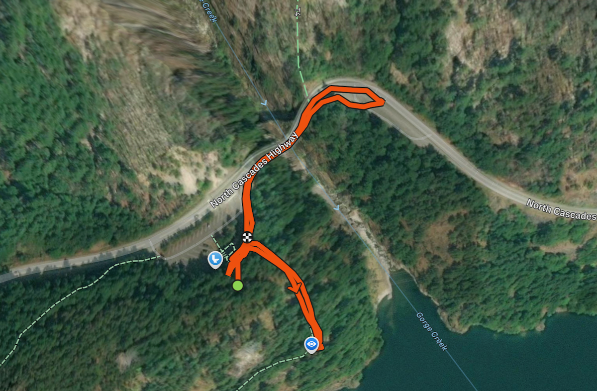
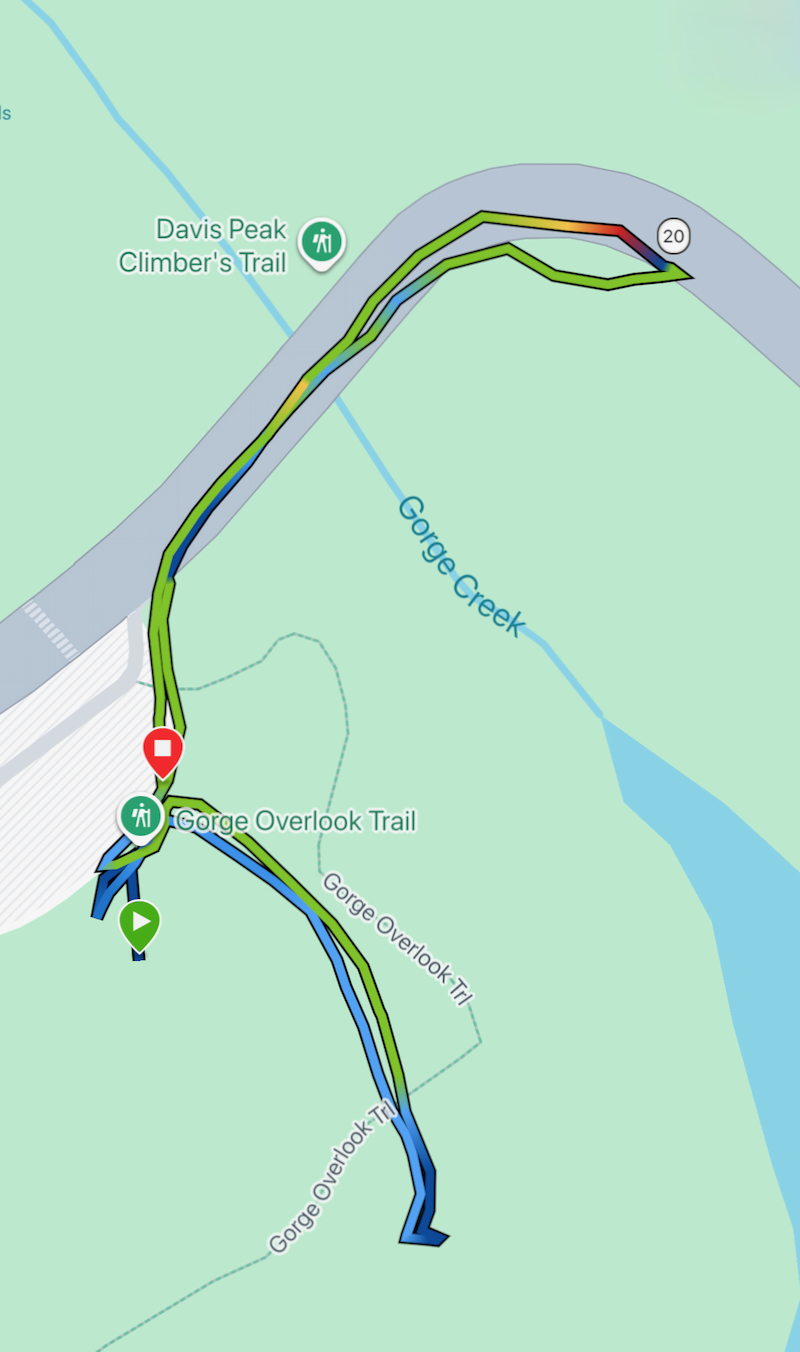
• Start time: 10:42 AM - • Course maps from Strava:
Pictures Tell the Story
Our first stop was the Gorge Overlook Trail, where we found ample parking across Gorge Creek from the trailhead. As we crossed the open diamond-shaped metal-grate bridge, I held my phone in a death grip and paused to snap a picture of the bone-dry Gorge Creek feeding into the Skagit River, just above the Gorge High Dam.

Once across the bridge, we began our easy walk along the beautiful paved path, which transitioned to dirt as we started the gentle climb to the overlook.


The short climb was well worth it, rewarding us with views of the vibrant, emerald-green waters of Gorge Lake, formed by the dammed Skagit River.

Garmin Stats
Garmin map and elevation chart…

Hike Overview
- • Location: Rainy Lake Trail in North Cascades National Park
• Start/Finish: parking lot near trailhead
• Course Type: out and back
• Course Surface: paved
• Distance: 2.46 miles roundtrip
• Moving time: 51:32
• Average Pace: 20:58 minute/mile - • Elevation Gain: 205 feet
• Elevation Range: 4,794 feet to 4,881 feet
• Weather: 60° and partly cloud
• Date of Hike: July 25, 2026
• Start time: 12:26 PM - • Course maps from Strava:

Pictures Tell the Story
Our second stop was the Rainy Lake Trail, an easy hike along a flat, paved path that leads all the way to the water. Along the way, we had a wonderful, long conversation with two women from Tennessee who had just hiked the more challenging Maple Pass Trail. Their trail branched off ours and climbed above the tree line, offering dramatic 360-degree views of the North Cascades. We tucked that recommendation away as a potential option for the next day.

As we made our way along the trail, the landscape felt delightfully rugged, with a deep green forest undergrowth thick with ferns and lush low-lying plants. Our route was also lined by an impressive amount of scraggly evergreens and trees heavily draped with unique, wispy green mossy lichens.


We arrived at beautiful, subalpine Rainy Lake just as shifting sunlight peeked out from behind the clouds, casting dramatic views across the water. Distant waterfalls cascading into the basin only added to the tranquility and beauty of the scene.


After a lovely time relaxing by the lake, we turned to walk back to our car. Moving along the forest path, we were struck by just how peaceful the trail had become. Timing really is everything, and we had landed in a perfect, quiet window with very few other people around.

On our way back, I stopped to take pictures of a lush patch of ferns and a small waterfall. This is where we paused to chat with the women from Tennessee, making it an extra nice place to take a breather.


As we approached the trailhead, we were greeted once again by a vibrant display of wildflowers lining the path. Going clockwise from the top left, we spotted bright magenta fireweed, delicate white Sitka valerian, purple mountain lupine, and cheerful yellow arnica.

Garmin Stats
Garmin map and elevation chart…


Hike Overview
- • Location: Happy Creek Forest Trail in North Cascades National Park
• Start/Finish: parking lot near trailhead
• Course Type: out and back
• Course Surface: wooden boardwalk and dirt
• Distance: .35 miles roundtrip
• Moving time: 8:04
• Average Pace: 22:53 minute/mile - • Elevation Gain: 99 feet
• Elevation Range: 2,163 feet to 2,263 feet
• Weather: 63° and partly cloudy
• Date of Hike: July 25, 2026
• Start time: 2:49 PM - • Course maps from Strava:

Pictures Tell the Story
Our third stop was the Happy Creek Forest Trail, where we scored a spot after circling the small parking area just once. The trail follows a beautiful wooden boardwalk with only a brief stretch of dirt, making it a peaceful way to soak in the scenery under a towering tree canopy.


Looking down, we were treated to Happy Creek tumbling over stones and creating pretty little waterfalls among the moss-covered rocks and ferns.


And looking up, we were dwarfed by a cathedral of soaring ancient trees. Massive Douglas firs and western hemlocks reached skyward, their thick, deeply furrowed trunks stretching toward a sun-dappled canopy far above.

Evidence of the forest’s natural lifecycle—fallen trunks serving as nursery logs and natural stream crossings along the trail.

Garmin Stats
Garmin map and elevation chart…


Hike Overview
- • Location: Ross Lake Trail in North Cascades National Park
• Start/Finish: parking lot near trailhead
• Course Type: out and back
• Course Surface: dirt, rocks, and roots
• Distance: 2.52 miles roundtrip
• Moving time: 1:03:01
• Average Pace: 24:58 minute/miles - • Elevation Gain: 997 feet
• Elevation Range: 1,375 feet to 2,151 feet
• Weather: 62° and partly cloudy with a short drizzle
• Date of Hike: July 25, 2026
• Start time: 3:34 PM - • Course maps from Strava:
Pictures Tell the Story
Our final and toughest hike of the day was the Ross Lake Trail, which kicked off with another parking challenge. Fortunately, we snagged a spot along the roadside directly across from the main lot, which serves several popular trailheads in the area.
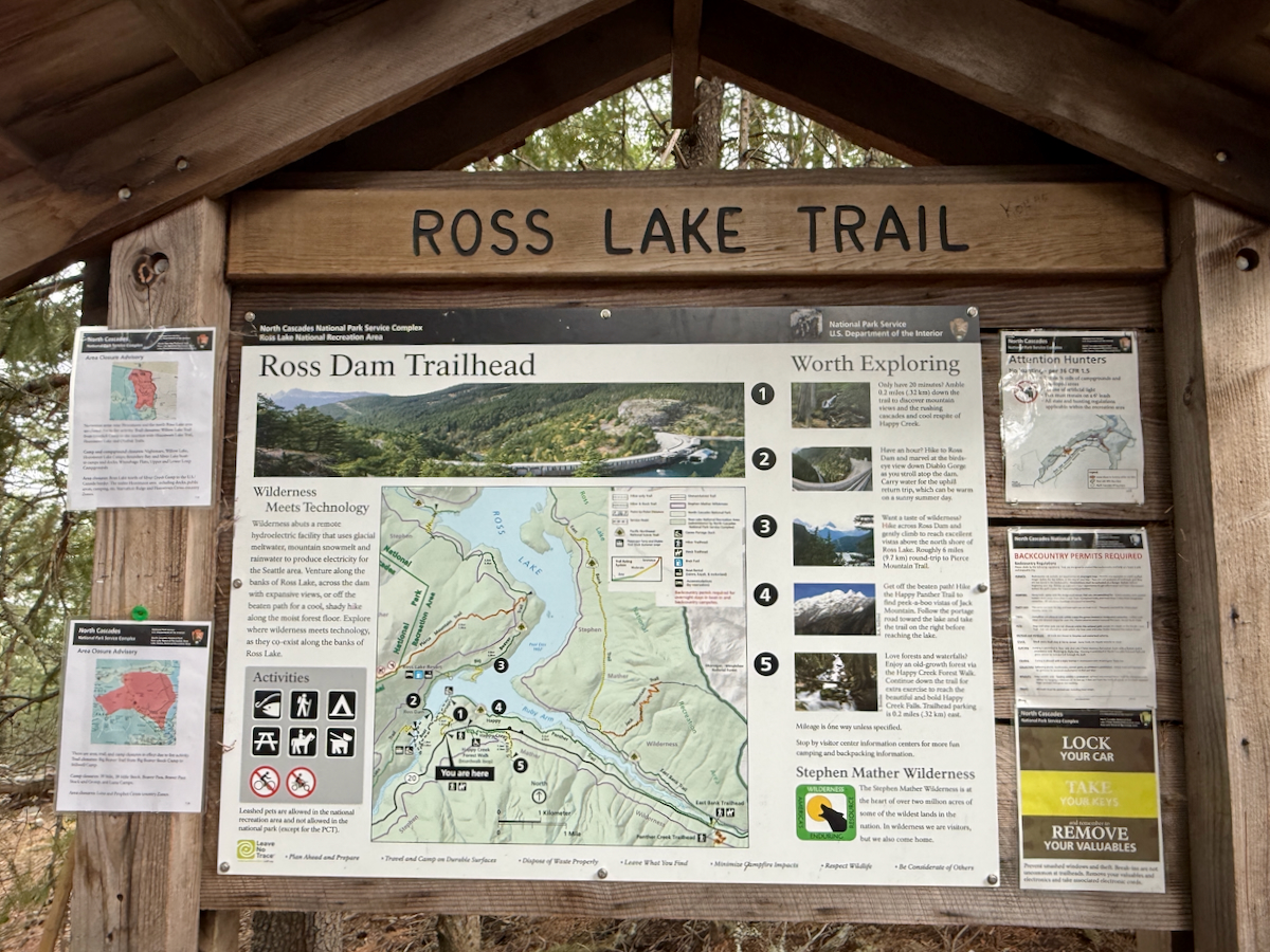
We immediately began our descent toward the lake, keeping the old adage in mind: “What goes down must come back up!” 😉 A light drizzle started to fall, raising worries that the trail might turn slick, but the rain passed through almost as quickly as it arrived.


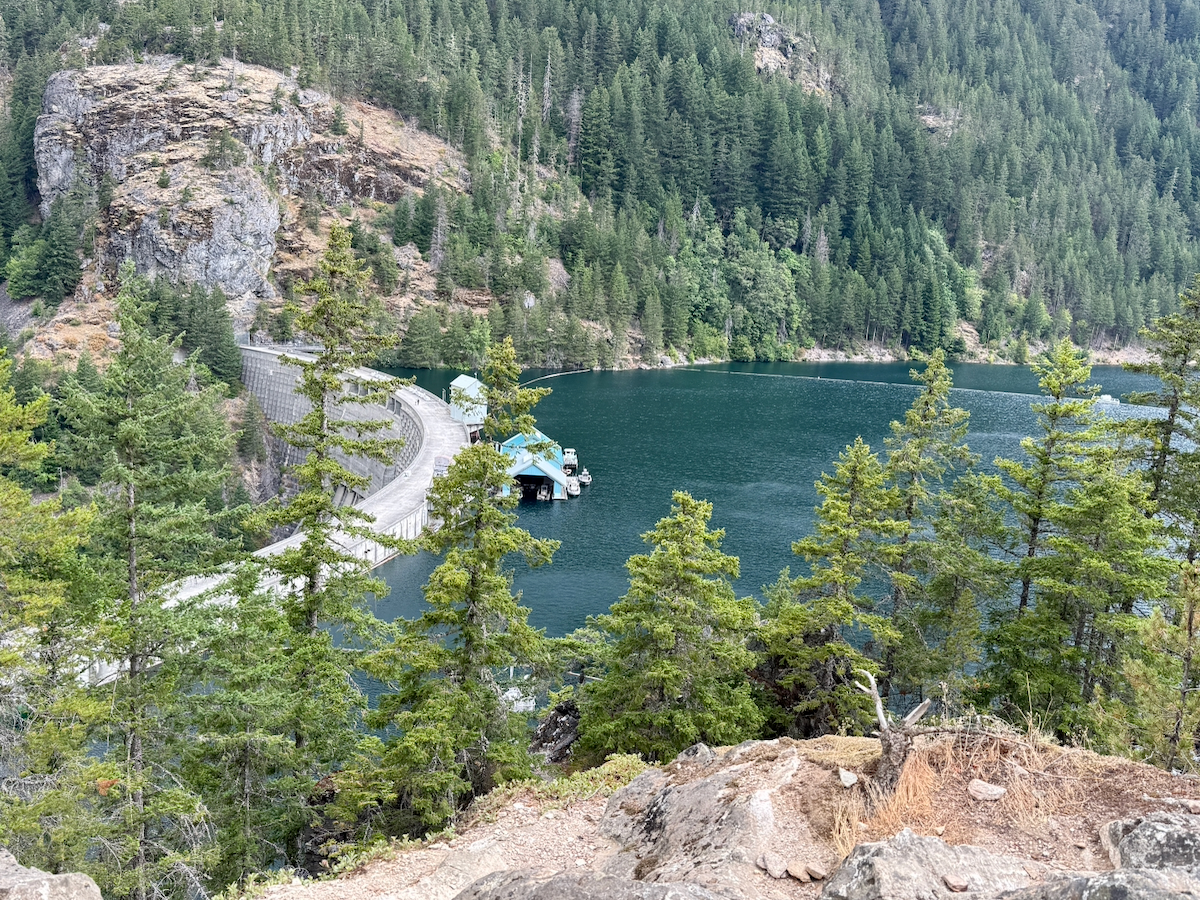
Anytime we hit a clearing, the views were incredible, and soon enough, we were treated to our first breathtaking glimpse of the impressive dam and the shimmering, turquoise waters of Ross Lake.
Eventually, the steep, technical singletrack merged onto a wider dirt access road (Ross Dam Road), though we got thoroughly dusted every time a pickup truck kicked up gravel as it passed us.

As we rounded the corner, Ross Dam came into view in all its engineering glory (can you tell I’m married to a civil engineer?). Completed in 1949, this giant concrete thin-arch structure towers 540 feet above the canyon floor stretching 1,300 feet across the Skagit River gorge, and holding back 23 miles of lake water, this massive concrete arch dam is a truly impressive piece of infrastructure.


After walking across the dam crest, I took a few minutes to explore the far side of the lake. The dirt trail keeps winding into the backcountry, but with time ticking away, I couldn’t venture too much farther.

As I made my way back across the dam crest, I noticed a pair of ears bobbing above the concrete barrier in the distance. Before long, a deer came running straight toward me on her way to the other side. I stood completely still, terrified of startling her—the last thing I wanted was for her to panic and jump over the wall into the lake or down the sheer drop on the lower side of the dam.


Heading back up, the technical sections of the climb weren’t nearly as tough as I’d anticipated—all that time spent in the gym definitely paid off! Once we made it out of the canyon, we crossed the now nearly empty parking lot and headed back to our car.


Garmin Stats
Garmin map and elevation chart…
Final Thoughts on Our Hikes
What a phenomenal day on the trails in North Cascades National Park! Each stop felt like a completely different world—from the accessible beauty of Rainy Lake to the lush, quiet boardwalks of Happy Creek and the dramatic canyon views at Ross Lake Dam.
Even with the parking challenges and a few dusty pickup trucks along the way, the breathtaking landscapes and quiet encounters with nature made it all worthwhile. The North Cascades truly live up to their reputation, and I’m already dreaming about our next trek into these mountains!
Questions
- • Have you ever visited North Cascades National Park, or is it on your travel wishlist? ~ This was our first visit.
- • What’s the most unexpected or surprising wildlife encounter you’ve ever had on a trail? ~ This deer was pretty unexpected! We were also treated to seeing a bull moose on the trail in the Grand Tetons while hiking on our honeymoon.
- • How do you handle hikes that start with a steep downhill, do you love the easy start or dread the climb back up? ~ I used to HATE trails that started with a descent, but these days I look at them as an adventure with climbing out at the end. It’s all about your mindset!
I’m linking up with Jenn from Runs with Pugs and Jenny of Runners Fly for Tuesday topics Link-Up. Be sure to check out not only the hosts’ posts, but those of the other great bloggers joining in on the fun!

Oh, I would LOVE to hike this area! I’d stop every five minutes to take pictures!
No wonder you let “pictures tell the story”, ha!
So nice that the weather cleared just as you arrived, especially after driving through all that smoke. And that Ross Lake hike sounds like quite the finale! Clearly all that gym work is paying off – it’s great to be fit enough to do all these hikes!
Meet me in North Cascades National Park and we’ll hike the Maple Pass Trail together. You’ll see in my next recap that we never made it back for those 360-degree sweeping views of the Cascades.