

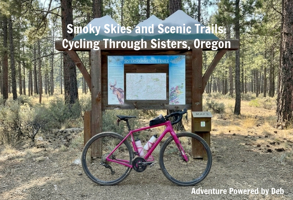
Peterson Ridge Trail System
The Peterson Ridge trail network offers miles of winding singletrack through majestic Ponderosa pines and high desert sagebrush in the Deschutes National Forest. Just outside Sisters, Oregon, this expansive system is renowned for its smooth, flowing dirt paths, gentle elevation shifts, and sweeping views of the Cascade Range. While peak summer dry spells can change the turns into loose, powdery sand, the network remains a standout destination for off-road cycling.
About the Ride
First, let’s get one thing straight: I am not a mountain biker! However, I traded my usual comfort zone for an adventure in Sisters, Oregon, joining two of our grad school friends for a multi-surface loop through the Deschutes National Forest. We navigated a mix of mountain bike trails, paved scenic highway, and nearly two miles of brutal, thick gravel. Between the heat, the smoke, and trails packed with deep sand, rocks, and loose gravel, it was honestly a pretty miserable ride! Thank goodness for the company of great friends—sharing the dusty trail with them made every fish-tailing slip worth it.
Ride Overview
- • Location: Sisters, Oregon
- • Course Type: loop
- • Course Surface: gravel, sand, and rocks with some pavement
- • Bike: Salsa Warbird
- • Distance: 19.2 miles
- • Moving Time: 1:58:13
- • Average Speed: 9.7 MPH
- • Elevation Gain: 407 feet
- • Elevation Range: 3,181 to 3,449 feet
- • Weather: 81° and sunny, climbing to 92°
- • Date of ride: July 31, 2026
- • Start time: 12:05 PM
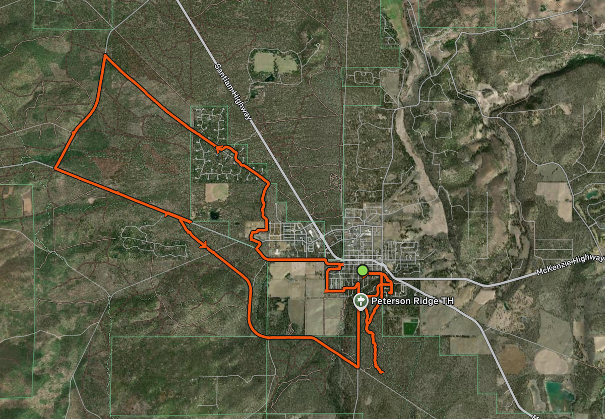
- • Strava map:
Fun Pictures from Along the Way
The smell of smoke hung heavy in the air the moment we stepped outside our friends’ home, a constant reminder of the nearby smoldering fires. Along our route, Smokey Bear stood watch—confirming the extreme fire danger and local fire bans in effect across the region.

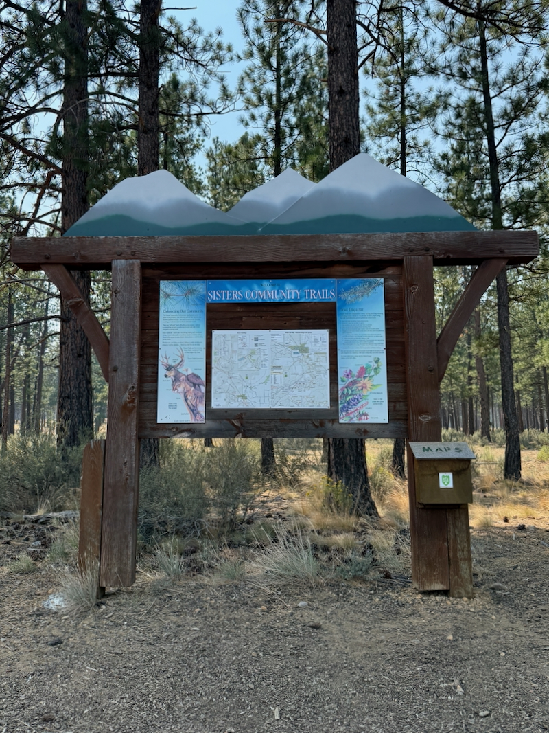
Undeterred, we drove over to the trailhead and stopped at the Sisters Community Trails kiosk to map out our route before setting off into the pines.
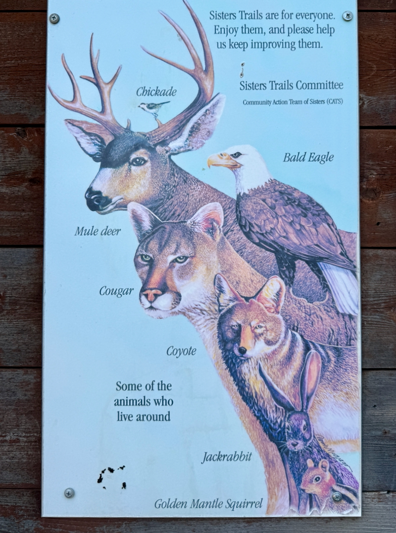
The trailhead kiosks featured illustrations of local wildlife and plant life to spot along the way. Animal highlights included mule deer, cougars, bald eagles, coyotes, jackrabbits, and golden-mantled squirrels. We saw none of those.
Native flora highlighted included penstemon, paintbrush, aspen, arrowleaf balsam, lupine, pinedrop, manzanita, and currant.

My Salsa Warbird looking bright, shiny, and ready to tackle whatever dusty trails lay ahead—even if I wasn’t quite ready for all the sand and deep gravel!

A mandatory group selfie before diving deeper into the dusty forest! Riding with great friends made every tough mile tolerable. LOL

The path started out as a gentle, twisting trail with decently packed dirt, but as the sand got deeper and my rear tire started fishtailing, my confidence plummeted. We eventually stopped to let some air out of our tires for better traction!


Once we left the sandy trails, we made a stop at Blazin Saddles. A super helpful staff member aired our tires back up to a pressure suitable for smooth gravel and pavement. I almost walked out with a new bike jersey, but they were unfortunately out of my size.


We were approaching the roads, but as the bumpy trail continued, I couldn’t help but wonder if we had aired up our tires a bit too soon!
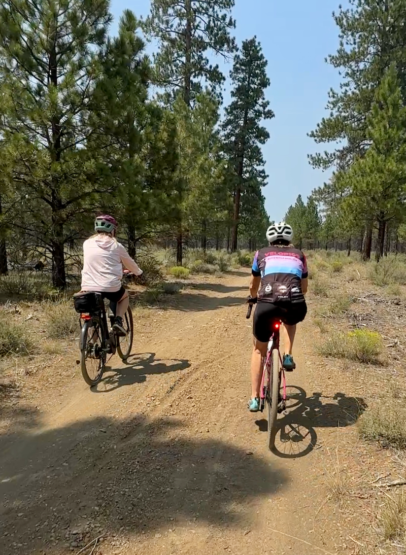
We rode along the bumpy washboard surface and loose gravel while tall ponderosa pines provided a gorgeous scenic backdrop despite the less than desirable terrain.


We rode onto a striking stretch of red cinder dirt road, slicing straight through the green pine forest and adding a welcome pop of color to our ride.

What a welcome sight when another bumpy gravel road finally transitioned back into smooth pavement!

We rode past the sign for the McKenzie Pass – Santiam Pass Scenic Byway—marking our first time back in this area since 1982!

We hit this stretch of thick, heavy gravel for nearly two miles, which quickly proved to be a bit too much gravel even for this gravel lover, and I didn’t think we’d ever get to the end of the road!

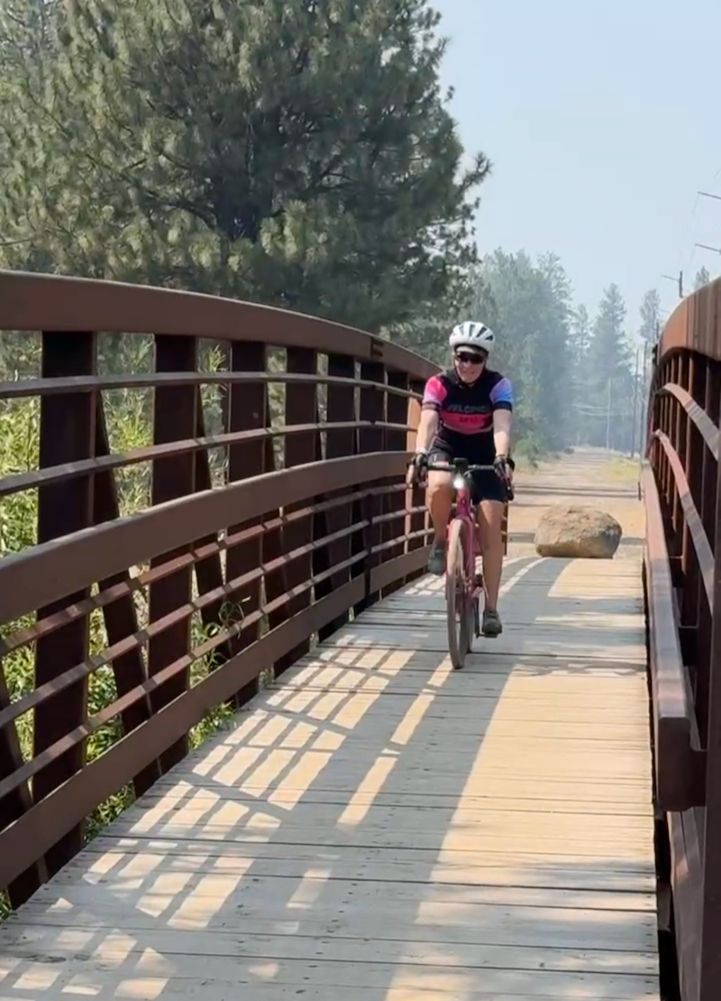
Finally off the gravel, we crossed the wooden bridge over Whychus Creek as we neared the end of our tough and smoky ride!
Garmin Stats
Post-ride Garmin…

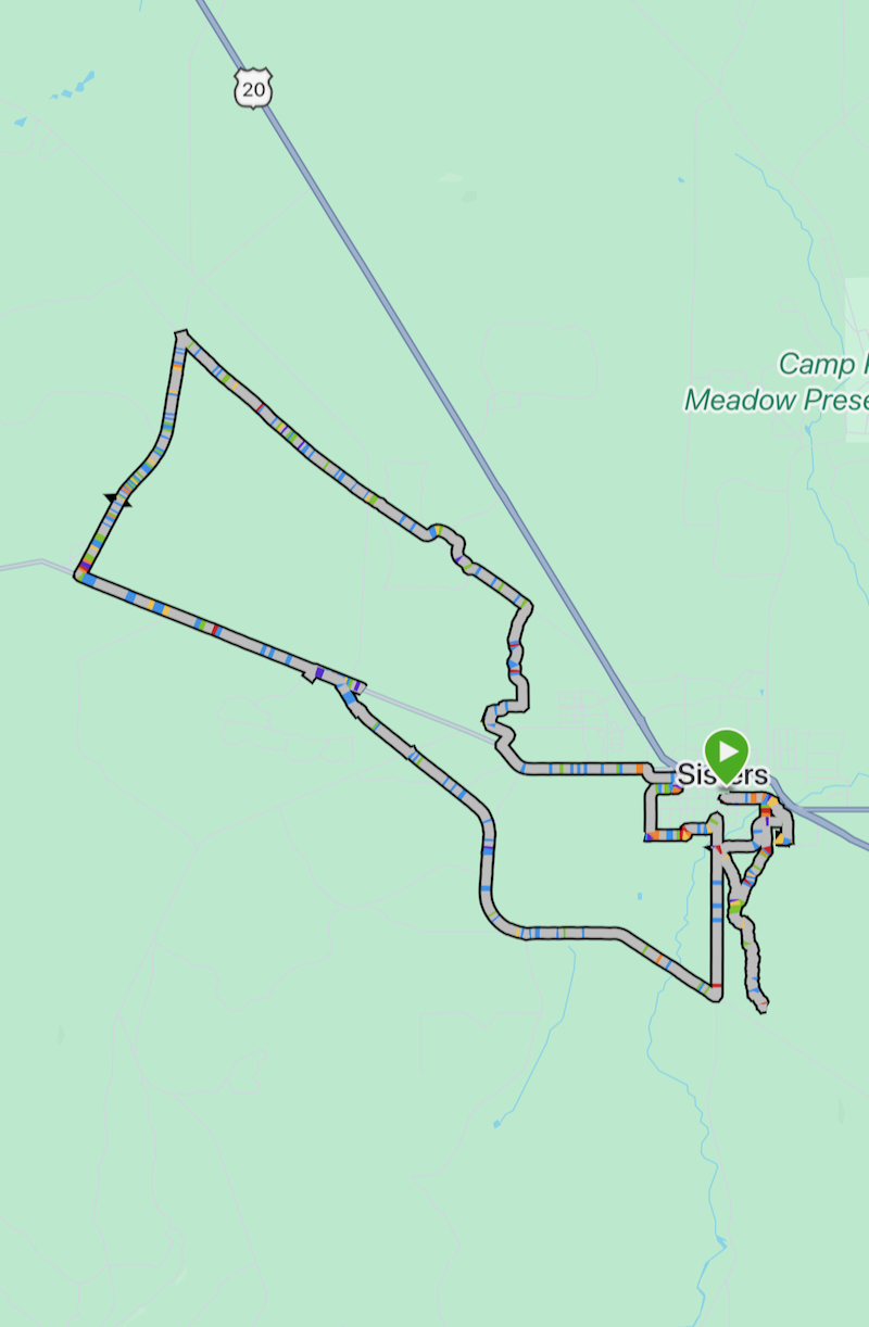
Garmin map and elevation graph…

Final Thoughts on the Ride
All in all, our 19.2-mile trek through Sisters was a wild, unforgettable sampler platter of Oregon riding! From deep, fishtailing sand, bone-rattling washboard dirt, and annoyingly thick gravel to smooth, paved stretches packed with 1982 nostalgia, this ride kept us on our toes (and constantly checking our tire pressure). The lingering wildfire smoke might have dimmed the mountain views a bit, but it certainly didn’t dampen the fun of tackling a challenging route with great company. My legs were thoroughly tired and my gravel limits were definitely tested, but rolling across that final bridge with a huge smile was the perfect end to an amazing adventure!
Questions
- • Do you try to pick up a local jersey or souvenir when you ride or hike somewhere new? ~ not really
- • What’s an outdoor activity or workout that turned out to be a bit more of a tough workout than you bargained for? ~ I thought this would be a super easy ride. I didn’t expect to encounter deep sand and gravel.
- • Do you stop and take lots of pictures when cycling or hiking? ~ yes
Oh, this ride sounds like quite an adventure, especially in the heat and smoke! At least you had good company to make the tough sections more bearable. Is one of your friends on an e-bike?
What a shame they didn’t have a jersey in your size, it would have been a cool souvenir of this ride!
For anyone with even the smallest amount of mountain biking skills the trails would be considered very easy, but my confidence just goes out the window when I encounter soft sand or big rocks to ride over. And yes, both of our friends were on eBikes. They’re coming to visit us in the spring and we need to rent eBikes for them to ride while here!
Yeah, I was bummed not to get that jersey. It was such a pretty mixture of colors and who doesn’t want a jersey that says, ” Blazin Saddles”!
You make biking seem so fun..
I just went on a hike and we went the wrong way – the challenging route up and easy route down.
No on jerseys and YES on photo stops.
Cycling is fun!
Another incredible adventure! I love that you are doing this!
I am all about all the photos during a run or hike or bike ride… or anything. Capturing moments is my favorite thing!
I will sometimes get a shirt if it’s cool enough.
It was certainly a fun roadtrip!
This looks beautiful, but sounds really tough. I don’t like riding on gravel. Remember the trail where your friend photobombed me? I tried cycling on that (gravel) trail once and hated it. I probably didn’t have the right equipment (or something) because other people seem to really enjoy it.
This does sound like it was an adventure!
You’re not alone in not liking to ride on gravel. One of our Dawn Patrol friends absolutely hates riding gravel and misses out on some fun rides with us!
What a wonderful ride! Sounds challenging too, but I’m sure the scenery made it less painful. Yes, I always do try to buy a shirt (not a bike jersey lol) when I travel. And I try to visit a brewpub to bring home a shirt for my hubs.
That two miles of deep gravel was just plain annoying! LOL
I do love finding a good t-shirt when we’re traveling, too.